
search
Istanbul transportation map
Istanbul public transport map. Istanbul transportation map (Turkey) to print. Istanbul transportation map (Turkey) to download. Istanbul local public transportation system is a complex network of trams, funiculars, light-rail lines, metro lines, buses, bus rapid transit, and even ferries as its shown in istanbul transportation map with more than 13 million inhabitants of the city spread over an area of 5712 km². Fares across modes of istanbul transportation are integrated, using the contactless Istanbulkart, introduced in 2010, or the older Akbil electronic ticket device.
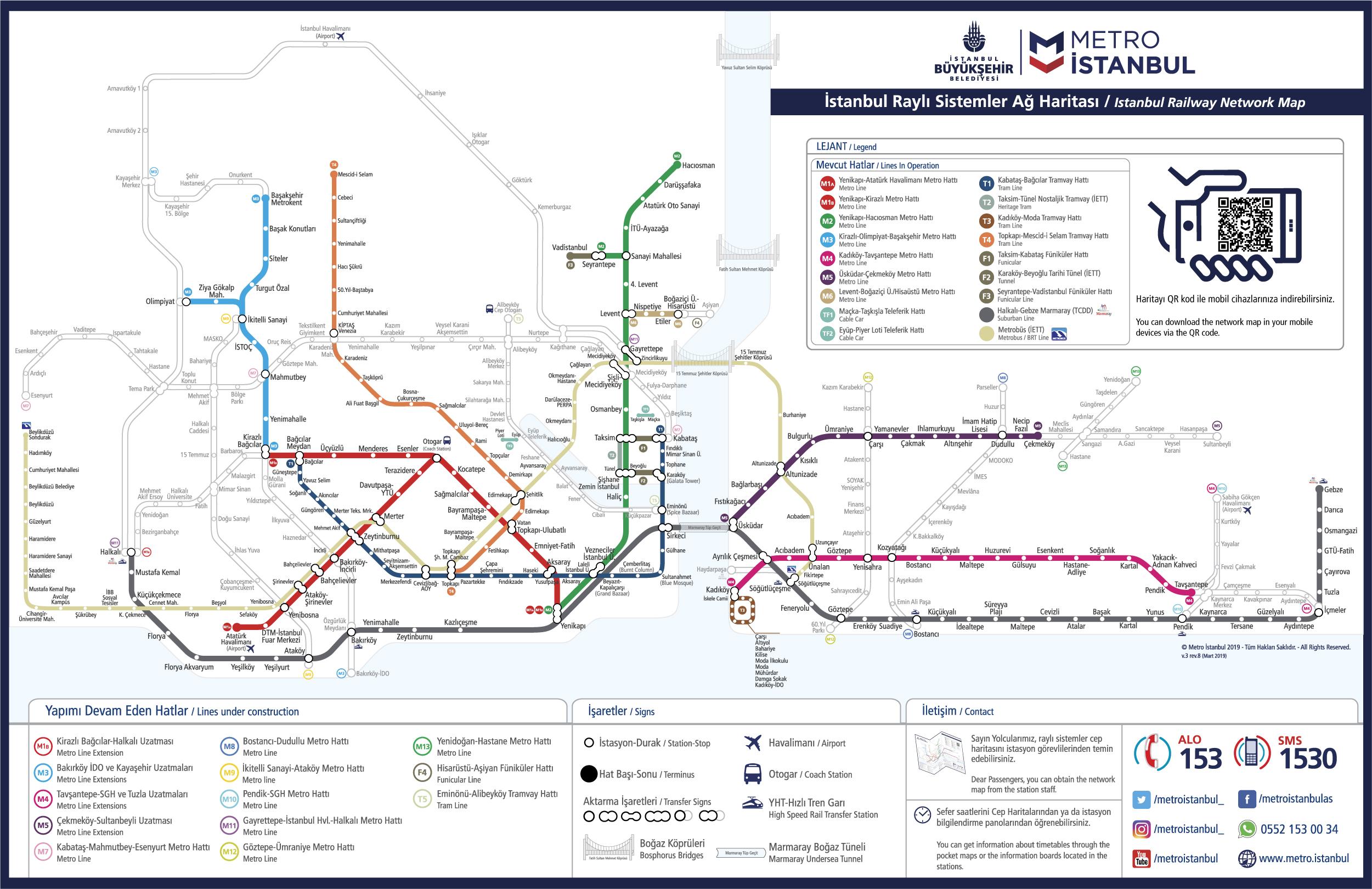
To travel from the European side to the Asian side, the best way of transportation is the ferries as its mentioned in istanbul transportation map. For travelling to the shopping and business districts of Nisantasi, Etilier and Levent, the best way is via the metro line that runs from Taksim Square. And the whole public transportation system in Istanbul can easily be accessed with a single transportation card, which is Istanbulkart.
Note that traffic in Istanbul is a major problem and often experiences gridlock particularly on the bridges. Also note that the Sultanahmet Square and most of the connecting roads are closed for vehicle traffic except tram and tour busses as youcan see in istanbul transportation map. Getting to Sultanahmet by istanbul transportation is useful, by your private car is not recommended. You will need to leave your car far away.