
search
Istanbul transit map
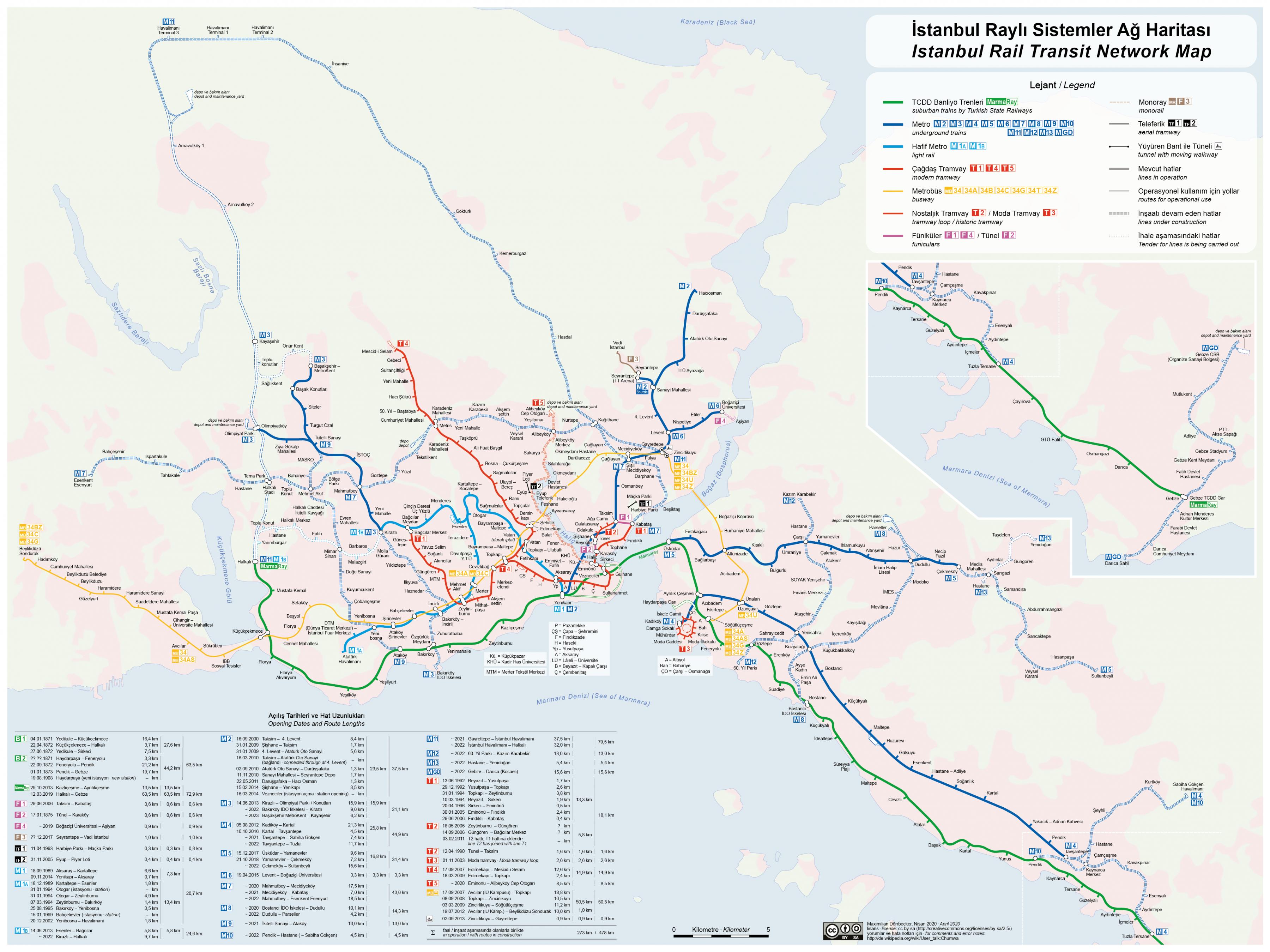
Istanbul rapid transit map. Istanbul transit map (Turkey) to print. Istanbul transit map (Turkey) to download. The Istanbul LRT is a light rail transit system consisting of 2 lines and operating by Ulaşım AŞ as its shown in istanbul transit map. The first line (M1) began service on September 3, 1989 between Aksaray and Kartaltepe. The line of istanbul transit light rail was further developed step-by-step and reached Atatürk Airport on December 20, 2002. The line has 18 stations and length is 19,6 km. As of 2012, dailyridership is 416 journey and 210.000 passengers. The other line (T4) was opened in 2007 between Edirnekapı and Mescid-i Selam. There are 22 stations and length is 15,3 km . Since March 2009, the line works between Topkapı and Hapibler Service is operated with LRT vehicles built by ABB in 1989. As of 2012, dailyridership is 380 journey and 100.000 passenger.
Bus rapid transit in Istanbul (BRT) is a term applied to a variety of public transit systems using buses to provide faster, more efficient service than an ordinary bus line (see istanbul transit map). Often this is achieved by making improvements to existing infrastructure, vehicles and scheduling. The goal of these systems is to approach the service quality of rail transit while still enjoying the cost savings and flexibility of bus transit. The expression BRT is mainly used in the Americas; in Europe and Australia, it is often called a busway, while elsewhere, it may be called a quality bus.