
search
Istanbul train map
Istanbul train station map. Istanbul train map (Turkey) to print. Istanbul train map (Turkey) to download. Marmaray is a train system connects the Europeand and Asian side under the sea as it shown in istanbul train map. The Marmaray is a 76 kilometers tube tunnel that provides passengers to pass under the Marmara inner sea with train in only a couple of minutes. The Gebze-Halkali Suburban Train System also use the Marmaray network which is also a fast way to travel between Asian side to European side of Istanbul, as well as from Sabiha Gokcen Airport (SAW) to the Istanbul city center.
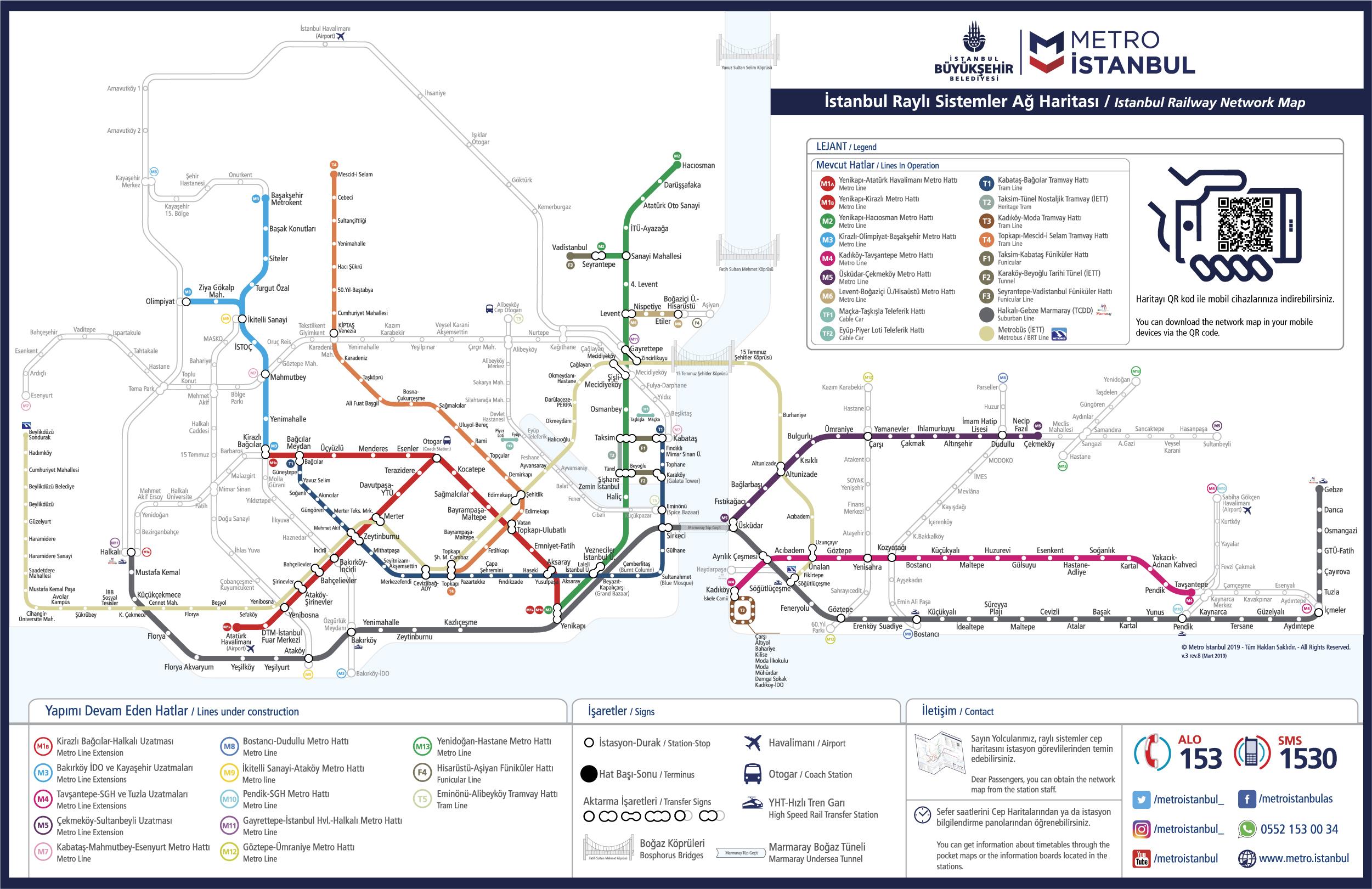
Trains for Asian destinations used to leave from the historic Haydarpaşa Station (as its mentioned in istanbul train map), a ferry ride across the Bosphorus from Sirkeci Station where the European trains arrive. Haydarpaşa train station was built in 1908, a gift from the German Kaiser to the Ottoman Sultan, and named after one of the Sultan generals. It was closed to long-distance trains in February 2012 when engineering work started to rebuild the rail approaches to Istanbul in connection with both the new high-speed line to Ankara and the new Bosphorus rail tunnel of Istanbul.
A pleasure to ride on and as good as anything in Western Europe, new 250 km/h high-speed trains are now operating on the Istanbul to Ankara, Ankara-Konya & Eskisehir-Konya routes as you can see in istanbul train map. Known as YHT, Yüksek Hızlı Treni, they currently come in two varieties, the original type designed by Spanish company CAF and the newer type designed by German company Siemens. Both types feature comfortable seats in Economy and Business classes. YHT high-speed trains started running from Istanbul (initially from a suburban station called Pendik, 25km east of Istanbul) to Ankara on 26 July 2014, extended to Söğütlüçeşme in central Istanbul from March 2019.