
search
Istanbul metro station map
Istanbul metro line map. Istanbul metro station map (Turkey) to print. Istanbul metro station map (Turkey) to download. Yenikapı, is a metro station that intended to be the hub of transport in Istanbul. You can already use the Marmaray from Yenikapı (the metro passing under the Bosphorus ) to reach Üsküdar on the Asian side as its shown in istanbul metro station map. while Haliç, is the most useful metro station for tourists wishing to reach the old town or for those wishing to go from the old town to other areas that seem less accessible. You will be near the spice market and Eminönü tram station (T1).
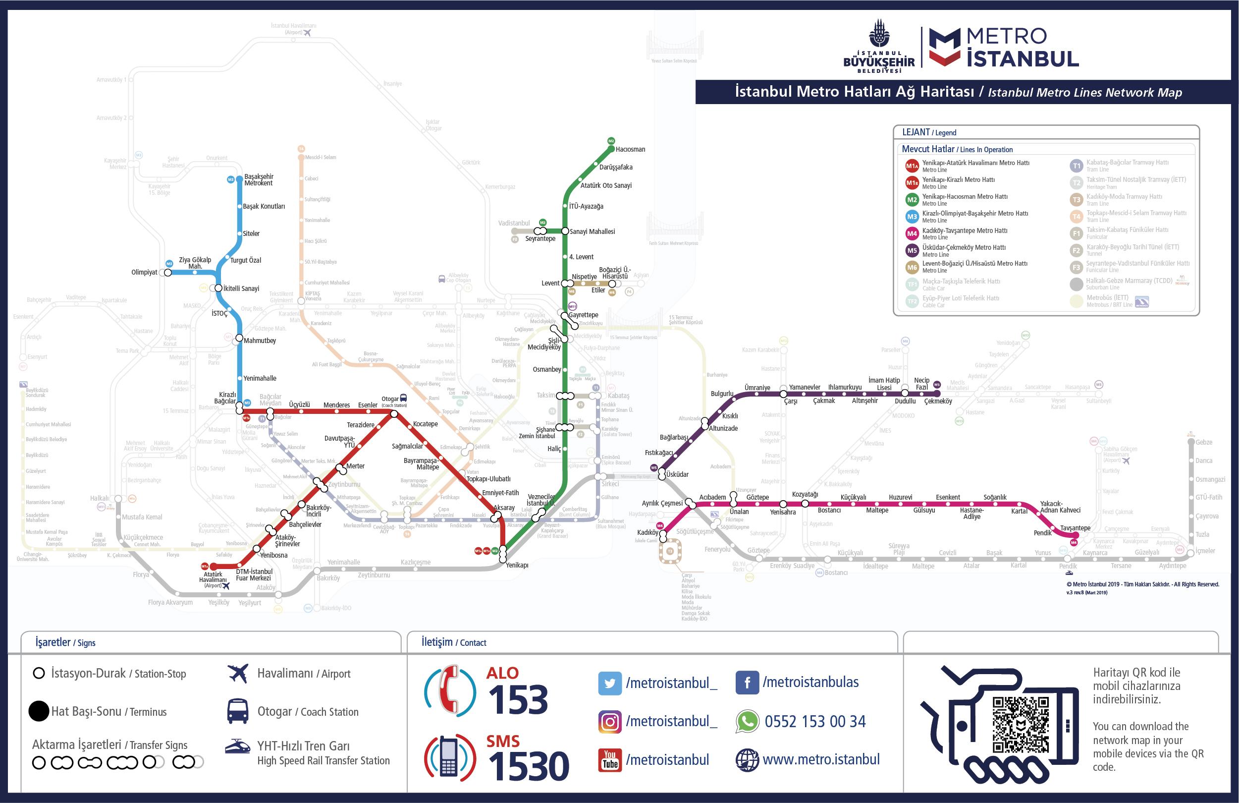
Şişhane — Located at the bottom of İstiklal Street, this istanbul metro station will allow you to reach the Tünel funicular located right next to the station, as well as the Galata district. Taksim — Located in Taksim Square, the metro station can be reached quickly by foot from the districts such as Cihangir, Beyoğlu or Çukurcuma as its mentioned in istanbul metro station map. You can also use the funicular (F1) to get to Kabataş where you will take the ferry for Asia and the Princes Islands, and the tram (T1) to get to the old town.
Osmanbey, this istanbul metro station is located just minutes from the upscale Nisantaşı district. Very nice area with many bars and restaurants as well as luxury shops and many Turkish designers. Levent — This is the business district of Istanbul. There is also close to the istanbul metro station two major shopping malls: Kanyon and Metrocity. İTÜ Ayazağa — Located near the chic shopping gallery İstinye Park (you need a little walk or take a taxi or a minibus). This gallery is a paradise for all lovers of fashion and luxury, you will find all the most luxurious brands.