search
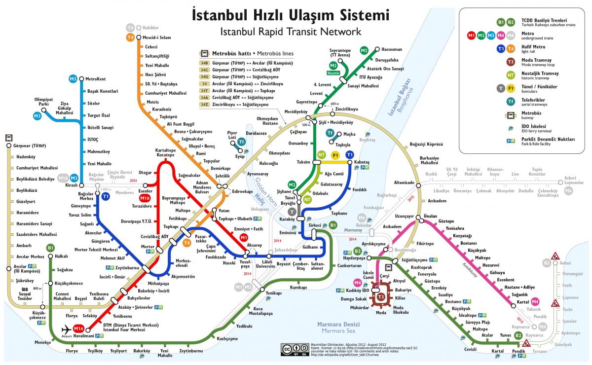
Istanbul funicular map
Map of istanbul funicular. Istanbul funicular map (Turkey) to print. Istanbul funicular map (Turkey) to download. The istanbul funiculars connect the lower part of the city with Taksim Square and its surroundings as its shown in istanbul funicular map. In Istanbul there are two funicular lines: Karaköy-Beyoğlu Tünel it is the second oldest underground transport in Istanbul after the London metro. Kabataş-Taksim Funicular, this funicular, much more modern than the other one, connects the T1 tram line with Taksim square. The Kabataş stop is close to the Dolmabahçe Palace.
Istanbul has a few funiculars and cable cars in the city. These methods of transportation would only be used for very short trips (Karaköy to Tünel Meydanı as its mentioned in istanbul funicular map) or for connections from the tram to the metro (Kabataş to Taksim Meydanı). The schedule of the funiculars in Istanbul is from 6 am to 12 midnight. The frequency is between every 5 and 10 minutes, depending on the time and day of the week. The price of the Tünel funicular is 1 lira. The Kabataş-Taksim is one Jeton.


