search
Istanbul bus map
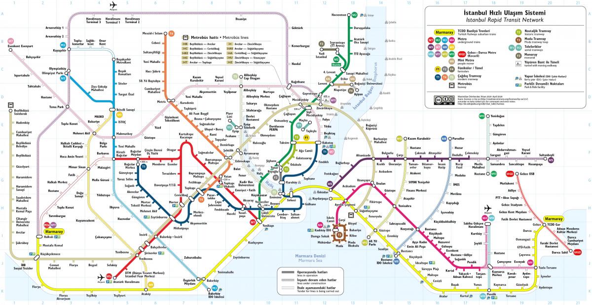
Istanbul bus routes map. Istanbul bus map (Turkey) to print. Istanbul bus map (Turkey) to download. The bus fleet of Istanbul has 5707 vehicles (total) built by MAN, Ikarus, Mercedes-Benz, BMC, Phileas, Otokar, Temsa and Güleryüz. Total number of daily ridership is 3 621 908 passenger and this number consisting %30 of Istanbul total transportation per day in 2012 (see istanbul bus map). Istanbul buses provide transportation within and between the two halves of the city.
The Metrobus, a form of Istanbul bus rapid transit, traverses the Bosphorus Bridge as its mentioned in istanbul bus map, with dedicated lanes leading to its termini. İDO (Istanbul Sea buses) runs a combination of all-passenger ferries and car-and-passenger ferries to ports on both sides of the Bosphorus, as far north as the Black Sea. With additional destinations around the Sea of Marmara, İDO bus of Istanbul runs the largest municipal ferry operation in the world.
One of the Istanbul buses registered Tramway Company had its first experimental operation on Beyazıt-Taksim route in July 2nd, 1927. Other Istanbul buses started to operate after five months on Beyazıt-Fuatpapa-Mercan Yokuşu-Sultanhamam-Eski Postane-Eminönü route as you can see in istanbul bus map. Later on this route extended to Karaköy. The first public buses of Istanbul started to service uphills of the Istanbul where it is harder for the tramways. Bağlarbaşı warehouse, previously used as a tramway hangar, turned into a garage for the maintenance and repair services of the buses in 1928.


