
search
Ataturk airport metro map
Map of ataturk airport metro. Ataturk airport metro map (Turkey) to print. Ataturk airport metro map (Turkey) to download. You can board a Metro train right beneath the ataturk airport and ride to Zeytinburnu, where you can transfer to the Kabataş tram for the ride to Sultanahmet Square, Sirkeci Station, the Eminönü ferry docks (ataturk airport metro map), the Galata Bridge, Karaköy and its ferry docks, and the Kabataş ferry docks and Füniküler to Taksim Square. Ataturk airport metro inexpensive, but slower, and not so easy if you have lots of luggage.
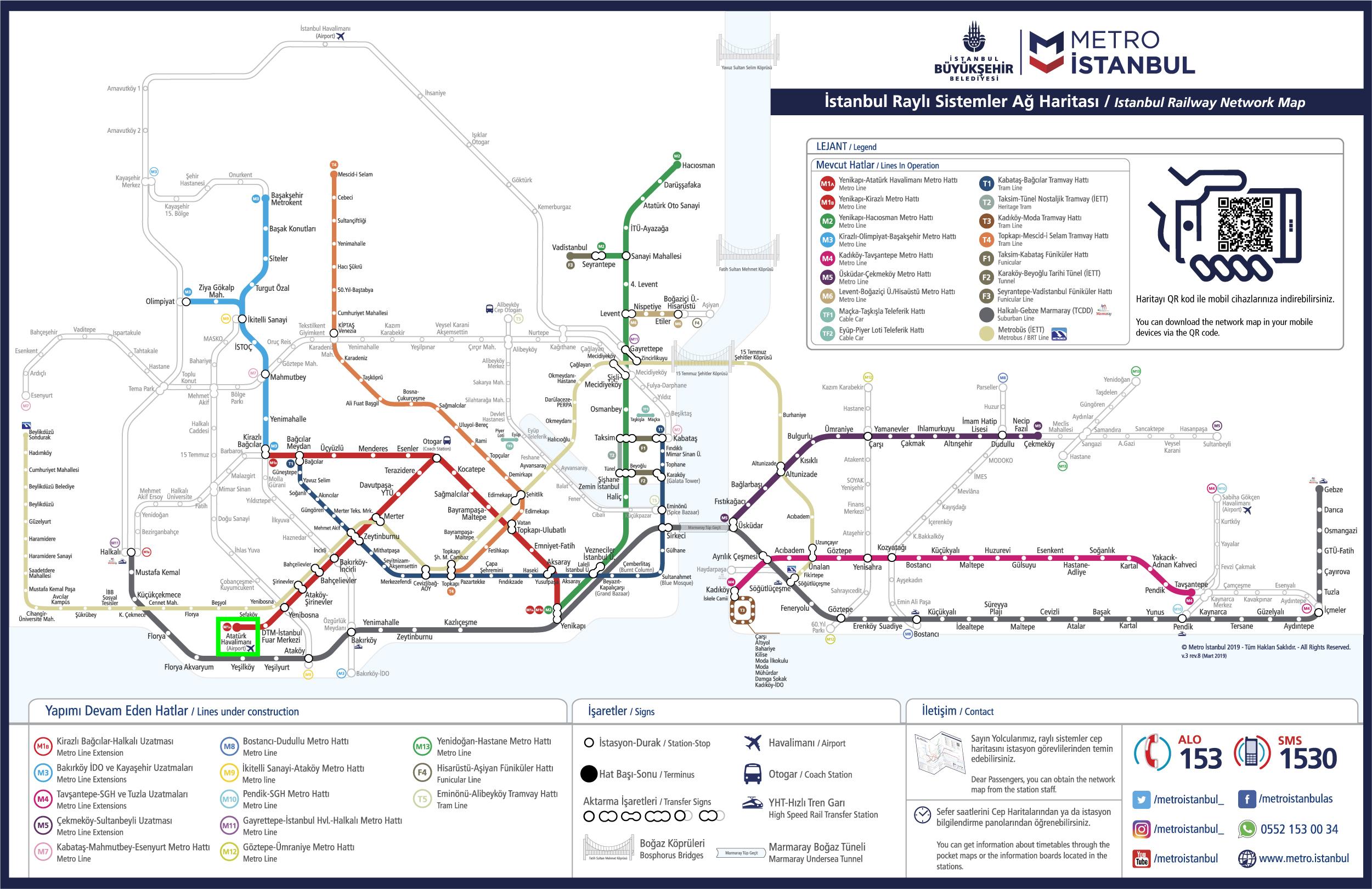
Although transport links to from the Istanbul ataturk airport are still being completed, there are various options to get to the centre of the city from Istanbul Atatürk Airport (IST) as its mentioned in ataturk airport metro map. Board a Metro train right in the ataturk airport at the Havalimanı (Airport) terminus and ride it to the Otogar station. You will be right at the center of Istanbul huge Büyük Otogar (international intercity bus terminal). In 2020 it is said that the M11 metro line which takes you to the north of Istanbul will reach the ataturk airport.