
search
Istanbul tram map
Tram map istanbul turkey. Istanbul tram map (Turkey) to print. Istanbul tram map (Turkey) to download. Trams in Istanbul date back to 1872, when they were horse-drawn, but even the first electrified trams were decommissioned in the 1960s. Operated by Istanbul Electricity, Tramway, and Tunnel (IETT), trams slowly returned to Istanbul in the 1990s with the introduction of a nostalgic route and a faster modern tram line, which now carries 265,000 passengers each day (see istanbul tram map).
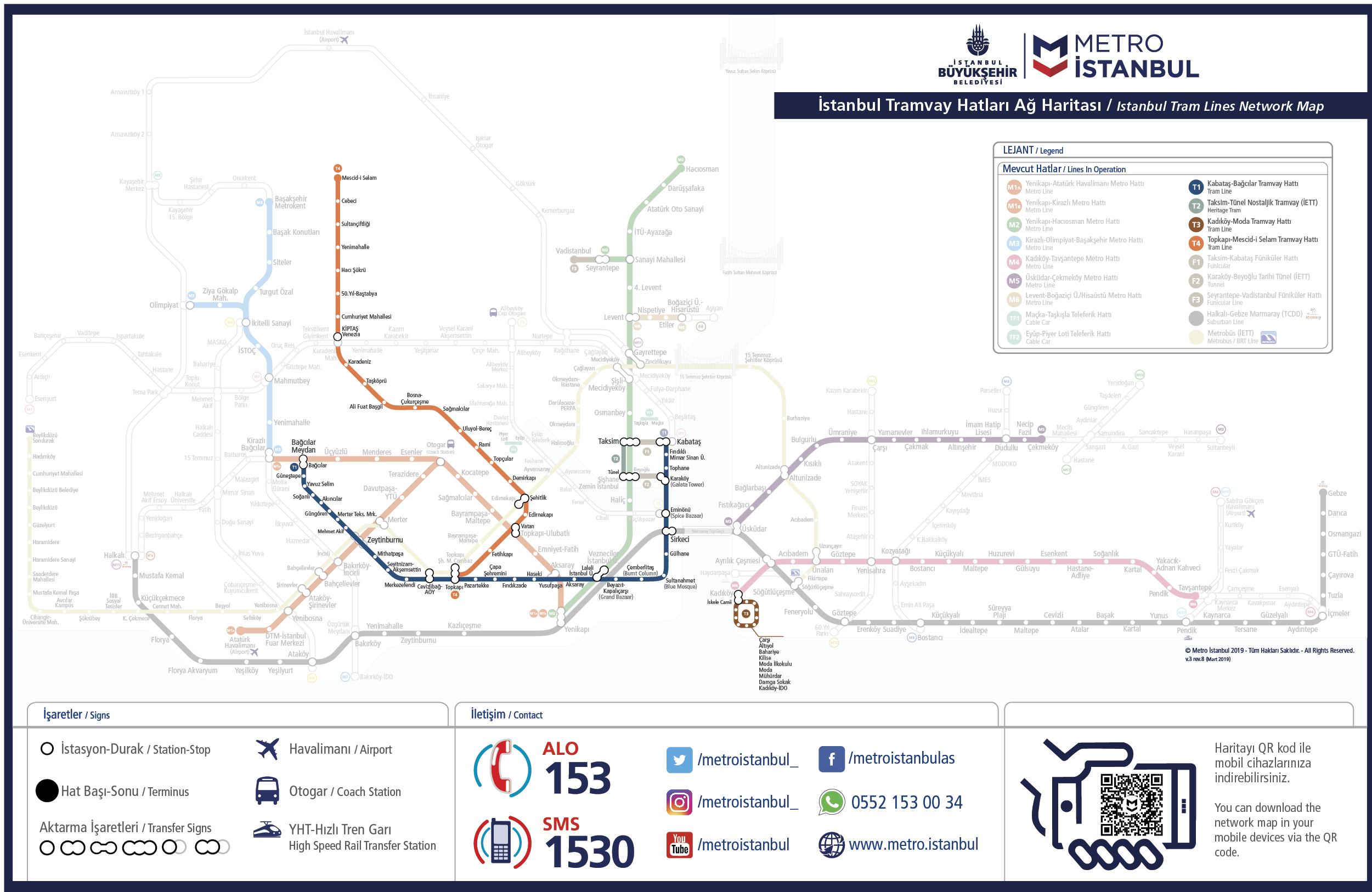
Trams in Istanbul are also a fast and easy way to travel around the most popular districts in Istanbul as its shown in istanbul tram map. The trams in Istanbul operate from Bagcilar to Kabatas (T1 line) (goes trough Eminonu and Sultanahmet), Topkapi to Mescid-i Selam (T4 line), as well as two nostalgic trams run between Taksim to Tunel (T2 line) through Istiklal Street on the European side and Kadikoy to Moda (T3 line) through Bahariye Street on the Asian Side of Istanbul.
By the end of year 1990,the historical tramline of Tünel-Taksim in Istanbul has recommenced to service with restoration of old wagons taken out from the museum. Istanbul tram has been operating on a line of 1640 meters with 3 mortises and 2 wagons (see istanbul tram map), making 14.600 trips, totaling 23.944 kilometers per year and carrying 6,000 passengers a day on average; as well as serving for touristic purposes.